Beginner, Family & Couples
First timer can apply, previous trekking experience is more appreciated.
Sufficient stamina to cover 4 km of distance in 35 minutes
Day 1 :Make Your Way from Shimla (2,276M) to Jiskun (2,099M)
Distance: 198 kms
Duration: 9-10 hours
If you have signed up with Bikat for a drive from Shimla to Jiskun, the day starts early. Everyone assembles at the meeting point by 7 in the morning so we can start our long drive up to Jiskun – a charming agricultural village in the Shimla district of Himachal Pradesh. Although there’s nothing more on the agenda for today other than the 10-hour drive, it is better to leave as early as possible for two reasons:
One, so we can reach as early as possible and give our bodies enough rest for what’s coming the next day. And, two, roads on the mountains are unpredictable and it is always better to account for delays when we start. It is also better to reach before it gets dark.
Day 2 :Bawta (2,350M) to Jhaka (2,750 M)
It’s a beatuful walk to smiatra from osla village and a mesmerizing view all over. after the long walk the treckers can rest for the day in their camp and get rested for the next day.
Day 3 :Jhaka (2,750M) to Saruwas Thatch (3,280M)
Distance: 8-9 kms
Duration: 6-7 hours
Today’s trail takes us all the way down to the river to walk alongside its beautiful blue waters as we follow all its curves and bends. The thicket of fir forests quickly transforms to patches of snow. On crossing these, a snow bridge and a wooden bridge, we hop and jump over some boulders and streams to enter another magical forest – this one rich in rhododendrons of varied hues.
A few more kilometers and we reach our campsite for the day – a massive field of meadows rich in all kinds of fresh colours.
Day 4 :Saruwas Thatch (3,280M) to Dhanderas Thatch camp (3,566 M)
Distance: 3 kms
Duration: 2 hours
Today is a short day since we covered a major part of the distance yesterday. Don’t mistake short for unexciting, however because this might as well be the best day of the entire trek which offers some of the most beautiful landscapes. This short walk on the colourful meadows takes us straight to the foot of the roaring Rupin waterfall which doubles up as our campsite for today. The magnificence of this trek is the constantly changing scenery – while the first day took us through fir forests, the second through rhododendrons, today we walk through the luminescence of silver oak trees until we end up at the campsite for the day – Dhanderas Thatch.
Day 5 :Dhanderas Thatch camp (3566 m) to Upper Waterfall camp (4080 m)
Distance: 4 kms
Duration: 3 hours
Today’s trek is relatively short but exciting! We will be making our way to the top of the Rupin Waterfall. This section is important because it gives you ample time to acclimatize to the changing altitude and prepare for what is to come next.
The morning begins at leisure allowing the trekkers to rest their limbs properly. For about 1 km, the trail is fairly level as you cross several streams on your way decorated with a display of wild flowers and marigolds. The next section is tricky as you reach the snow patches at the base of the waterfall. This is when your snow equipments like trekking pole and ice-axe would come into play. The trek on snow is particularly challenging as the trail is steep and narrow in many sections. This continues for the next 1.5 kms before you reach the meadow at the top.
The Upper Waterfall Camp is a gorgeous meadow on the banks of a gently flowing stream. You will get to see the spectacular mountain ranges covered in snow and several streams running down through them merging into the Rupin river and disappearing below your feet. While everyone has seen a waterfall closely, only a few can claim to have seen it right from the top and observe it fall down right into the valley. You will one of those lucky few. Capture this moment at the most cinematic location one can imagine. This campsite is a true sight to behold!
Day 6 :Upper Waterfall camp (4080 m) to Rupin Pass (4657 m); Rupin Pass to Ronti Gad Camp (4005 m)
Distance: 4 kms + 4 kms
Duration: 6-7 hours + 2-3 hours
This is perhaps the longest and the most thrilling day of the trek. We begin as early as 5 AM and carry packed lunch and breakfast along to reenergize ourselves on the way. The challenges begin to appear shortly after we begin the trek. The ascent to Rati Pheri is a steep incline veering through snow and gains a generous amount of altitude in an hour. The trail climbs over a ridge before reaching the campsite of Rati Pheri.
The landscape changes beautifully at Rati Pheri – a promise best kept by the Rupin Pass trek! The expansive views of the Rupin valley are replaced by the alpine Dhauladar range as you now move ahead over vast snowfields. Your trek leader will provide you with appropriate snow equipments such as microspikes and gaiters depending upon the level and density of snow on the trail. From Rati Pheri, the trek is steep and quite demanding as the snow makes it difficult to trudge through. It is slipper in some sections, while at others the snow may be knee-deep demanding every ounce of your energy to take that next step. All the snow techniques you have learnt so far are put to test and how so. In about 3.5 hours, you will finally reach the base of the Rupin Pass gully. Take some time to rest and rejuvenate for the gruelling trek ahead.
The Rupin Pass gully is a narrow and steep half tube in the mountain side that is prone to lose stones falling over. It stretches over 200 m and would take anywhere between 40 minutes to 1 hour to cover, depending upon the level of snow and the speed of the trekkers.
After a long and steep icy-climb, the sight of the saddle shaped Rupin Pass cutting its way through the Dhauladar Ranges rewards you with a feeling of pure bliss and euphoria. Hundreds of stone cairns and colourful prayer flags adorn the ridge line that offers impressive views of the Kinner kailash range in the north and the Rupin valley in the south. Spend some time at the ridge and relish the eternal glory of the spectacle in front of you.
The next phase of the trek steps up the fun quotient by a notch or three. To reach the Ronti Gad campsite, you get to glissade down the chutes of snow. The descent is sharp and rapid and sliding down the snow slope is the best way to cover the distance.
The slopes even out, after the steep descent, making for an easy walk. Once you cross snowline, be prepared for another sharp descent that leads you to an endless meadow with a stream flowing gently through the mountains. This is the Ronti Gad Campsite. You will be camping here for the night in the vicinity of the towering snow-capped mountains – yet another pleasant change in the landscape around.
Day 7 :Upper Waterfall camp (4080 m) to Rupin Pass (4657 m); Rupin Pass to Ronti Gad Camp (4005 m)
Distance: 13 kms + 225 kms
Duration: 5-6 hours trek + 7 hours drive
We begin the descent to Sangla after breakfast, at around 9 AM. The trail is a dusty shepherd’s path as you move out of the Ronti Gad campsite. You may come across mule traffic and shepherds tending to their cattle along the way. Almost 2 hours into the trek, you will see the Ronti Gad valley retreating slowly behind you and the trail ahead opening up to first glimpses of the snow-clad Kinner Kailash range. The sight is an absolute marvel to behold.
Soon afterwards, you will see the first signs of civilization afar in the tiny village of Sangla Kanda. Take a quick break in the Sangla Kanda village and have a hot cup of tea to give yourself some respite from the sharp descent.
The trail from Sangla Kanda to Sangla veers through blue pine forests that come as a refreshing surprise. The trek gradient is a rapid decline over a broad well-defined path going through terraced farms, apple orchards and old stone houses.
As you finally reach Sangla, take one last look at the giant mountains around and bid adieu to one of the finest cross-over treks of the country.
*We will reach Shimla late at night, so make your hotel reservations accordingly
Moderate
15275 Ft.
8 Days, 7 Nights
Apr – June, Sep To Nov
Rupin pass trek at the altitude of almost 15200ft starting from Dhaula in Uttarakhand and ends at Sangla in Himachal Pradesh is the only trek offering adventure of two beautiful cities. This 55 km trek will keep on surprising with every step you take. The trek is moderate to difficult and is suitable for experienced trekkers offering variety of terrains be it snowy, rocky or plain. Along your trek you will come across hundreds of waterfalls and they will appear as if falling straight from the sky. You walk along the serene blue water of rupin river. The unique Jhaka village also know as The Hanging village. Lush green forest of pak and pine trees. Kinnaur temple and the mesmerizing views of kinner kailash. This is and ideal trek for all the nature lovers as it is where the two river Yamuna and Satluj originates. It is accessible through out the year but the best time to visit it is said to start from April and continues till september, if one wants to cross those snow bridges you can also visit it in winter season. This beautiful trek with ethereal waterfalls , serene meadows, breathtaking glaciers and and beautiful snow and water streams is a must for all the trek out there who have that thirst for exploring adventure.
1. Smoking and drinking are not recommended.
2. Follow the trek instructor or guide in order to enjoy a safe trekking experience.
3. No intoxication in any means during the trek.
4. Avoid trekking in nights without the conscience of trek guide
5 .carry all the personal medications to be safe in the trek.
6. All the trek takes place through eco friendly zones ,so do not encourage littering the local sites or camp sites or on the trek route.
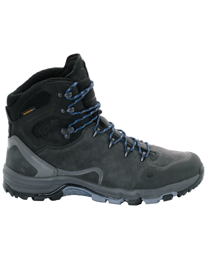
Trekking Shoes (Waterproof, Ankle support)
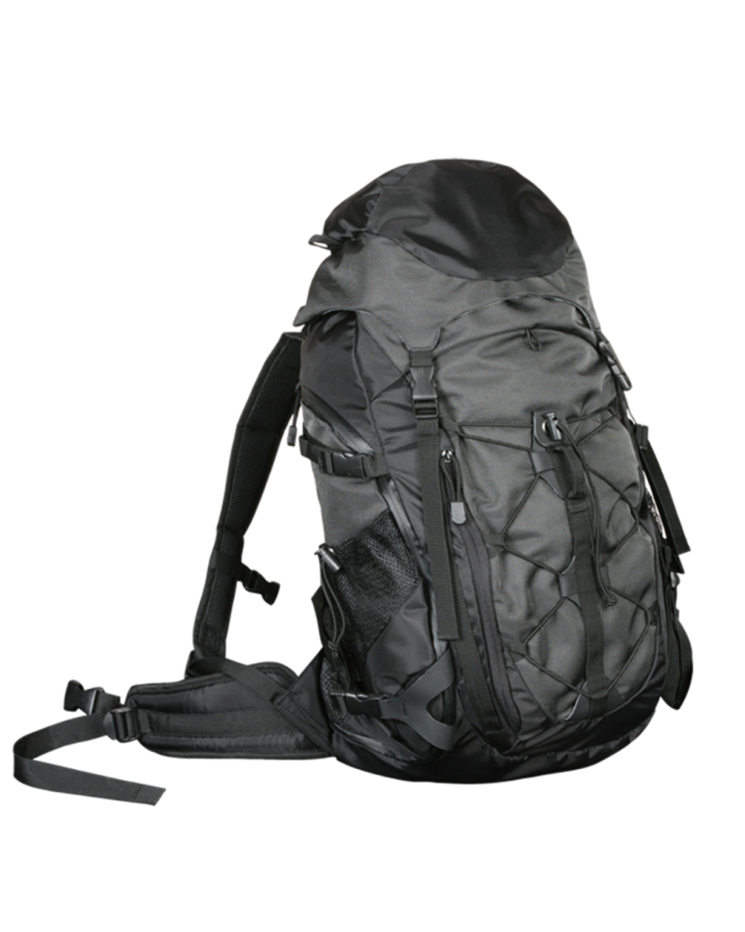
Rucksack with raincover (40-60 litre)
Daybag/Daypack (10-20 litre)
Jacket : (Windproof, Down jacket, Fleece jacket)
Woolen/Fleece Clothes
Thermal Inners
Woolen Cap
Hand Gloves (Waterproof/Woolen/Fleece)
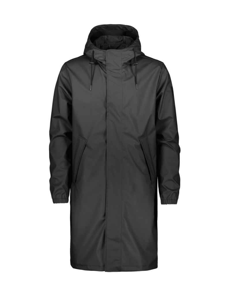
1 Raincoat/Poncho
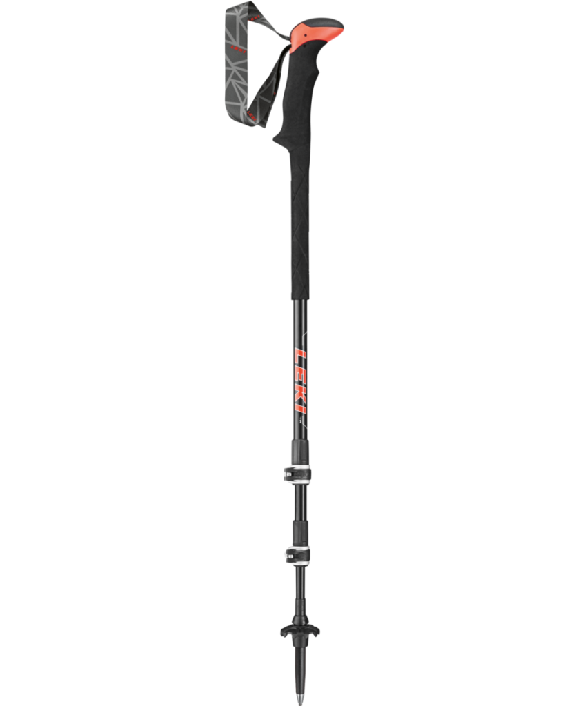
Trek Pole/Walking Stick
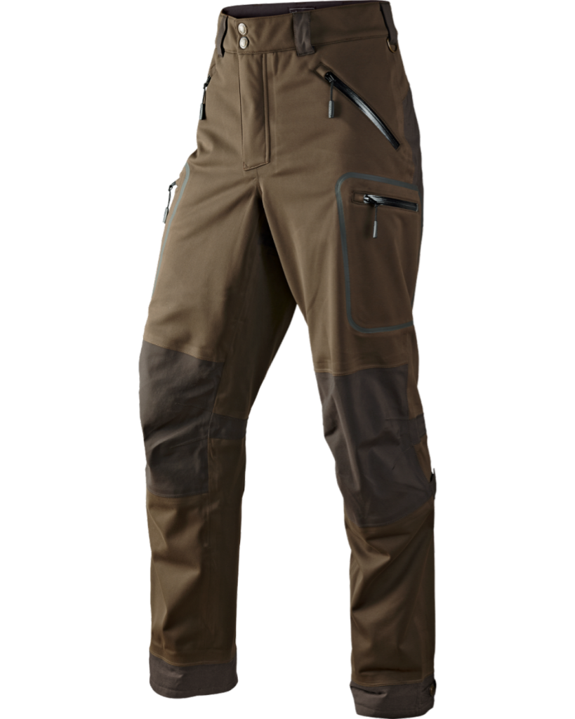
Trek Pants (Windproof/Waterproof)
3 T-Shirts (Collar/Full Sleeves/Rapid dry)
Socks (3 pairs)
Neck Cover
2 water bottle (each 1 litre)
Slippers/Floaters (Non-slippery)
Lunch Box / Tiffin
Hat or sun protection Cap
Head Lamp / Hand torch
Sunglasses (UV protected)
Personal Toiletries
Hand Sanitizer
Toilet Paper roll
Sun Screen (SPF 40-60)
Moisturizer/Lip Balm
Glucose/DryFruits/Energy Bar
Personal Basic Medical kit
**Microspikes/Crampon and Gaiters Included in package
**Personal ID card (original with photocopy)
We are Certified Member of ATOAI (Adventure Tour Operators Association of India).
Being ISO ISO 9001: 2008 certified company and member of ATOAI (Adventure Tour Operators Association of India) we are known for best safety practices and excellent services.
Organising expeditions at over 100 peaks across the Himalayas that are permitted by the IMF.
Get in touch with us. E-mail us Monday-Saturday (10 AM to 6 PM)
2024 Himalayan Peak Adventures. All rights reserved